
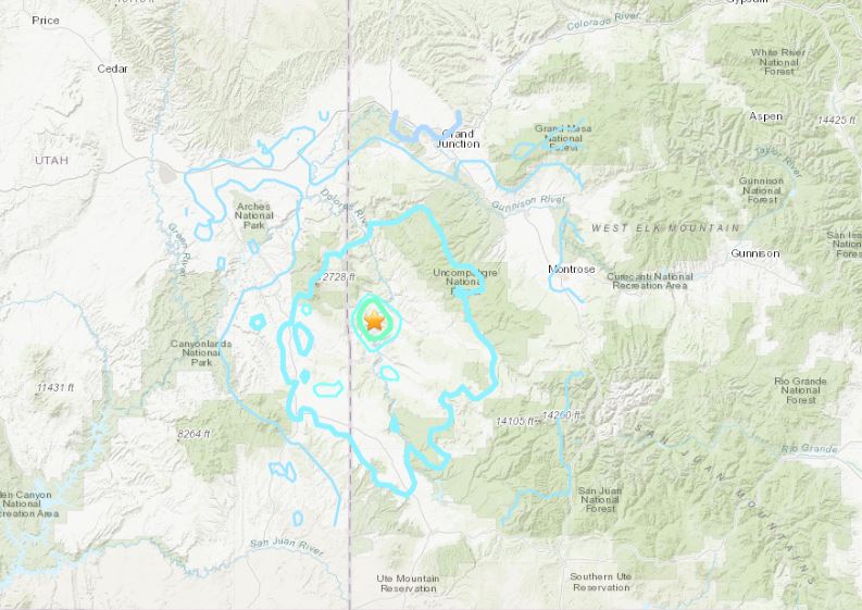
NEW [V4]: 04 Mar 2019 17:22:52 GMT
Mag=5.3, 38.2803 N, 108.9110 W, Dep=0.8 km
4 km SSW of Bedrock, CO


A 4.6-magnitude earthquake struck Monday morning about 10:22 a.m. 4 miles south of Bedrock, Colorado. Several residents in Moab and Monticello have felt the quake. Over 650 reports of felt shaking have already been received by USGS.
The M4.6 earthquake was very shallow (0.8 km) and felt over a wide area with more than 659 people reporting feeling some shakings in Utah and Colorado.
The USGS initially reported the quake was 5.3 magnitude, before quickly downgrading it to 4.6. TOO STRONG TO BE TRUE? Such earthquakes happen very rarely in Colorado! The largest recent earthquake was a M5.3 in 2011.
NEW [V4]: 04 Mar 2019 17:22:52 GMT
Mag=5.3, 38.2803 N, 108.9110 W, Dep=0.8 km
4 km SSW of Bedrock, CO
The epicenter was located about 40 miles southeast of Moab.
An #earthquake centered on Dove Creek, CO was just felt in #Moab. It registered 5.3 on the Richter scale at origin. We have not received any reports of damage or other issues related to the tremor. Details on the USGS site > http://ow.ly/gwkA30nUTyP #utah
Over 100 earthquakes shook the Bluffdale, Utah area between Feb. 13 and 21., the highest magnitude being 3.7.
The most recent, notably large earthquake in Colorado occurred August 23, 2011 just southwest of Trinidad. The largest earthquake in Colorado history was Nov 7th, 1882, near Rocky Mountain National Park; estimates vary but it was about a Magnitude 6.5.
http://strangesounds.org/2019/03/colorado-earthquake-utah-border-map.html
Moab police said in a tweet they have not received any reports of damage or any further earthquake-related issues.